2016
|
Multi-frequency sub-bottom profiling for Nanjing
Geological Survey Center in China
Meridata recently won a tender issued for the supply of a
multi-frequency sub-bottom profiling
system for the requirement of Chinese Geological
Survey Bureau Nanjing Geological Survey Center. The system
with pertinent software has been delivered in cooperation
with Qingdao Watertools and will serve in the Geological
Survey Center's research in shallow inland waters.
|
Swath bathymetry solution for Civil Tech
Meridata has delivered a swath
bathymetry system to Civil Tech, an independent
survey consultant based in Kemi�nsaari, Finland. The
supply entails a Sonic 2024 multibeam echosounder, a
motion reference unit and instrumentation for measuring
sound velocity. Furthermore, Meridata was contracted to
deliver MDCS real-time data
acquisition software and MDPS
software for expedient processing and cleaning of
multibeam data.
|
Multi-mode system commissioned on Yangtze River
In February 2016, Meridata performed, in cooperation with
representative Earth Products China (EPC), delivery and
commissioning of a multi-mode
river bed mapping system for Changjiang Insitute of
Survey Technical Research, Ministry of Water Resources in
China.
The delivered system seamlessly integrates dual-band chirp sub-bottom profiling,
seismic reflection profiling
and side-scan sonar survey,
enabling the Institute's geophysical department to
simultaneously employ several different hydroacoustic
methods in their underwater surveys.
|
2015
|
RIO
Acoustics 2015
The 2015 edition of IEEE/OES Acoustics in Underwater
Geosciences Symposium, RIO
Acoustics, will take place from 29 to 31 July 2015
in Rio de Janeiro, Brazil.
According to the organisers, the symposium will address
acoustics in investigating aquatic environments and
ecosystems from land to open ocean with a wide diversity
of applications. The technical programme of RIO
Acoustics 2015 encompasses the newest techniques and
technologies to solve challenges in ocean engineering,
environmental protection, fisheries management, underwater
mining and inland hydrometry.
Meridata will support the symposium as one of its
patrons. We have also gladly accepted the invitation
to submit a presentation on "Integrated Use of Multiple
Acoustic Frequency Bands for Sub-bottom Profiling" for the
symposium's technical programme.
|
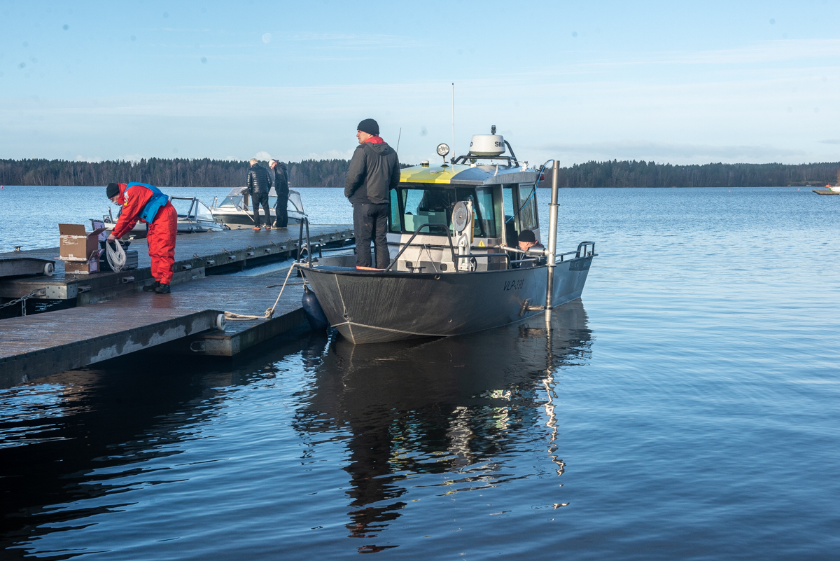
Data acquisition system
for GTK's M/V Geomari 
The Geological Survey of Finland (GTK) has contracted
Meridata for complete renewal of marine geophysical data
acquisition on board their main marine geological research
platform, M/V Geomari.
The upgrade which comprises facilities for parallel
acquisition of seismic reflection, side-scan sonar and
multi-band chirp and pinger sub-bottom profiling data, as
well as navigation data from several instruments, was
successfully commissioned in May 2015.
M/V Geomari is shown on the photo on the right (image
copyright GTK).
|
University of Espirito
Santo orders Meridata system for multi-frequency
sub-bottom profiling
The Department of Oceanography and Ecology at the
University of Espirito Santo has placed an order with
Meridata for a multi-frequency system for sub-bottom
profiling. The purchase, funded by Finep-CTInfra,
comprises Meridata's high-definition, dual-band chirp
sub-bottom profiler, a boomer seismic reflection profiler,
as well as Meridata MDCS and MDPS software packages.
The University's Laboratory of Geological Oceanography
will use the system for various research projects in need
of multi-frequency imaging of sediment strata along the
Atlantic coasts of Brazil.
|
FCG Finnish Consulting Group Oy commissions new
survey vessel

FCG has recently commissioned their new survey vessel for
operations in the northern Baltic. The 14-meter catamaran,
Nordic Sonar, has been built and equipped to meet some
very specialized needs of the FCG survey teams. It is
based in Turku, Finland and has been fitted with Meridata
systems for marine geophysical surveys.
Nordic Sonar is an advanced and versatile survey platform
capable of performing multibeam and single beam
bathymetry, seismic reflection profiling and sub-bottom
profiling, as well as side-scan sonar surveys.
|
2014
|
New ultra-high resolution chirp sub-bottom profiler from
Meridata

Meridata makes available a new ultra-high resolution
chirp sub-bottom profiling system.
The adjacent profile was captured with the new Meridata
chirp system in the Baltic Sea. First systems with this
ultra high resolution capability have already been
delivered. Many vendors specify a sediment layer
resolution of a few cm for their SBPs, but this one
actually is able to deliver it � resolutions of better
than 3 cm have been achieved in testing. Besides this
extremely high resolution capability, this system exhibits
exceptional shallow water performance. These two features
make it ideal for detailed studies of surficial sediment
in lakes, reservoirs, and basin areas in both coastal and
offshore waters.
The new chirp system has the capability to operate on a
broad frequency spectrum from 2 kHz to 50 kHz, offering
the choice of frequency bands of 2-9 kHz, 10-20 kHz and
20-50 kHz � two of which can be used simultaneously.
Adding a seismic profiling subsystem operating at below 1
kHz will further enhance the system's penetration
capabilities, truly affording surveyors with a full image
of sediment strata. Intelligent triggering management
enables all acoustic subsystems to be deployed in concert,
without interference.
|
inctAmbTropic
- Federal University of Bahia orders MD DSS
multi-frequency sub-bottom profiling system
Meridata has been contracted to build and deliver a multi-frequency sub-bottom profiling
system for the inctAmbTropic - Federal University of
Bahia. The system will be commissioned in 2014, and
entails subsystems for simultaneous dual-band chirp
sub-bottom profiling as well as seismic reflection
profiling utilizing boomer and sparker sources.
Furthermore, the supply includes a portable MDCS data acquisition solution and
multiple licenses of MDPS
post-processing and interpretation software.
|
Meridata sediment mapping solution for Luode
Consulting
Luode Consulting, an independent company providing
expert services in water quality and sediment related
issues, has opted for Meridata's MD
DSS system for multi-faceted mapping of sediments in
both natural and built underwater environments. The new
system is due for delivery in April 2014, and will have
capabilities of wide-band, high resolution chirp
sub-bottom profiling, seismic reflection profiling as well
as side scan sonar mapping. Luode Consulting will use the
system to complement their sediment sampling services in
the Baltic Sea region.
|
2013
|
New MD DSS sub-bottom profiling system for
University of Sao Paulo
The Oceanographic Institute of University of Sao Paulo
has, for a number of years, been operating a multi-mode,
multi-frequency MD DSS system in their marine geological
research projects. Meridata has now received an order for
the upgrade of the university's system, covering our
latest-generation dual-band chirp operating on frequency
bands 2-9 kHz and 10-20 kHz, refurbish of the existing
boomer seismic reflection profiling system, as well as
all-new MDCS and MDPS software for data collection,
processing and interpretation.
|
Side scan
and bathymetry for Geological Survey of Estonia
Meridata has just been awarded a contract to supply a
combined system for bathymetry and side scan sonar survey
to the Geological Survey of Estonia (EGK). Besides
equipment, the system encompasses a full suite of MD
software for acquisition, processing and interpretation,
and will be commissioned for use in seafloor studies along
the Estonian coasts in the Baltic Sea.
|
Acoustics
in Underwater Geosciences Symposium
The IEEE/OES Acoustics in Underwater Geosciences
Symposium will be held on 24 through 26 July 2013 in Rio
de Janeiro, Brazil. The symposium has been organised
to address the growing need for a forum on shallow water
geophysics, and more precisely, acoustics tools used in
ocean engineering, environmental management and mineral
exploration projects.
Meridata will support the symposium as one of its
patrons. We expect this event to become unique and
rewarding for participants, organisers and supporters
alike.
|
MDCS
version 5.2 launched
Meridata has released version 5.2 of MDCS software for marine
geophysical data acquisition. In many aspects, the new
version brings MDCS in line with our MDPS processing and
interpretation software, streamlining geophysical survey
and data processing workflow.
MDCS 5.2 has, besides many other new features, extended
support for third-party instruments and systems,
including:
- Sonic 202x multibeam echosounders from R2Sonic
- System 3000, System 3900 and System 5000 side scan
sonars from Klein
- 4000 series side-scan sonars from Edgetech
- 3000 series sub-bottom profilers from Edgetech
- G881 and G882 magnetometers by Geometrics
MDCS also offers precise GPS time synchronisation, tide
(water level) and sound velocity profile management, as
well as a Navigation Planning and Support (NPS) module
with advanced facilities for survey planning and real-time
presentations of survey progress.
|
MD DSS
suite for Institute of Geology in Estonia
The Institute of Geology, an independent institute at the
Tallinn University of Technology, Estonia has awarded
Meridata a contract to supply and commission an MD DSS multi-mode, multiple
frequency acoustic system for mapping of bottom
sediment in shallow waters. The system is scheduled for
delivery by July 2013, and entails subsystems for seismic reflection profiling
(boomer), chirp sub-bottom
profiling and side-scan sonar
survey. An integrated data acquisition system with MDCS software will be part of the
delivery, as well as MDPS
software for processing and interpretation of collected
data.
The system will
be used to survey
sediment thickness and distribution in the coastal
waters as well as in inland lakes and rivers.
|
Another MD
DSS goes to Brazil
SALT Ambiental,
of Sao Paulo, Brazil, will soon be operating a new MD DSS system.
Meridata has been issued an order for the delivery of
multi-mode, multi-frequency acoustic survey system for use
by SALT Ambiental. The MD DSS will comprise subsystems for
bathymetric, seismic reflection, chirp sub-bottom
profiling and side-scan sonar survey, along with a
real-time data acquisition and post-processing facilities.
SALT Ambiental specializes in oceanographic,
limnological, meteorological and geophysical studies, and
offers their services in environments ranging from
oceanic, coastal, and estuarine to inland waters.
|
2012
|
Meridata sponsors Baltic Sea Marine Geology Conference
Meridata has been invited to sponsor the 11th Colloquium
on Baltic Sea Marine Geology, a conference hosted by the
Geological Survey of Finland, and held on board m/s Silja
Serenade from 19th to 21st September 2012. The conference
will cover several topics relating to Baltic Sea marine
geology, including �Geoscience in the Baltic Sea energy
development� as well as �Changing sea level and coastal
processes through time�.
We gladly have accepted this opportunity to support
research in this field of Marine Sciences, and wish all
participants a stimulating conference.
|
Seismic reflection profiling for Shaw
Shaw Brasil, of the Shaw Group has taken delivery of an MD DSS system
for their sub-bottom profiling work. In addition to the
sub-bottom profiling equipment, the supply included MDCS
software for navigation planning/support and data
acquisition, as well as MDPS software for processing and
interpretation of seismic reflection and sub-bottom
profiler data.
|
Meridata releases version 5.2 of MDPS
Meridata recently released MDPS
version 5.2, introducing many new features. For details
and information on upgrading licenses not covered by a
maintenance agreement, contact info@meridata.fi.
MDPS is use by a large number of organisations dealing
with varying types of marine geophysical data � including
bathymetry, seismic reflection, sub-bottom profiling and
side-scan sonar data. MDPS has good potential to boost
processing productivity while enabling users to make more
informed and more accurate interpretations of their
hydroacoustic data.
|
2011
|
Meridata delivers MD DSS to Singapore
A contract was recently awarded to Meridata for the
supply of an MD DSS system for the National University of
Singapore. The order resulted from the efforts of
Meridata's Asian representative Sensomarine Pvt Ltd.
|
Multi-frequency sub-bottom profiling system for
Brazilian University
Meridata has been contracted to supply an MD DSS multi-mode,
multi-frequency sub-bottom profiling system to the Federal
University of Bahia in Brazil. The system includes control and data acquisition
facilities, chirp and boomer subsystems, as well as MDPS post-processing and
interpretation software.
|
Seismic profiling for GTK
Geological Survey of Finland (GTK) has placed an order
for a seismic reflection profiling system. The system will
be used to survey stratigraphic conditions in lakes with a
variety of glacial and postglacial sediment structures
ranging from fine clay to coarse till. The new equipment
will complement GTK's existing system which already
provides concurrent bathymetric,
sub-bottom profiling and side-scan sonar survey.
|
FCG Finnish Consulting Group deploys chirp
sub-bottom profiler
Finnish Consulting Group (FCG) has just taken delivery of
a new MD DSS chirp sub-bottom
profiler system.
The chirp system, including facilities for data acquisition, processing and interpretation, was
installed in the company's survey vessel M/S Kummeli
which already is fitted with hydrographic and marine
geophysical equipment, and undertakes survey work in the
Baltic Sea.
|
MD DSS system delivered to India
Meridata has completed the supply of a multi-mode digital sonar system to
a national research institute in India.
The system comprises a wide-band chirp
sub-bottom profiling subsystem, as well as side-scan sonar subsystem, control and acquisition system,
ancillary positioning, motion and attitude sensors, plus a
full MDPS processing and
interpretation software suite.
|
2010 and before
|
Chirp
sub-bottom profiler contract
MBT GmbH, based in Kiel, Germany, and part of the
MacArtney group, has just placed an order for an MD DSS chirp sub-bottom profiler
system. This system, including facilities for data acquisition, processing and interpretation,
will be installed in a SWATH type Hydrographic Survey
Vessel, newly built by the German shipyard Abeking &
Rasmussen for the Estonian Maritime Administration.
|
Data
acquisition system delivered to Vietnam
Meridata has supplied a seismic reflection profiling data
acquisition system for Marine Geology and Mineral
Resources Centre (MGMRC) in Hanoi, Vietnam. The
acquisition system will be used to collect data from a SIG
7mille sparker profiling
system supplied by S.I.G. Technologie, France. The sparker
has energy level selections from 160 to 7000 joules to
enable survey from the shallow water regions in North
Vietnam to the deep water areas of southern Vietnam. The
project has been carried out by joint efforts with S.I.G.
and REXCO, Vietnam.
|
Seismic profiling system to University of Rio Grande
Universidade Federal do Rio Grande � FURG has placed an
order with Meridata for the supply of a seismic reflection
profiling system, complete with a data acquisition system,
as well as post-processing and interpretation facilities.
The system is due for delivery in May 2010 and will enter
duty with the Oceanographic Institute's Laboratory of
Oceanographic Geology.
|
Polish Geological Institute purchases MDPS
We are pleased to announce that the Polish Geological
Institute has opted for Meridata's MDPS
for processing and interpretation of their marine
geophysical survey data. The Institute's Marine Geology
Branch collects large sets of seismic reflection,
sub-bottom profiler and side-scan sonar data, and now
joins the tens of users around the Baltic Sea already
utilizing MDPS for handling their marine geophysical
survey data.
The Polish Geological Institute � National Research
Institute (PGI-NRI) is the official Polish Geological
Survey and the Polish Hydro-geological Survey under the
general supervision of the Ministry of the Environment.
The Institute's Marine Geology Branch (MGB) is located in
Gdansk, and works with geological and geochemical mapping
of the seafloor, as well as detailed geological,
geomorphological and geodynamical investigation of the
coastal zone. MGB has afforded their expertise to several
EU-funded projects, and has also issued numerous
geological publications and maps on the Polish part of the
Baltic Sea. MGB has extensive digital databases with
seismic and geological data from the Polish EEZ and Polish
coast, containing about 6000 grab samples, 900 vibrocores
and 200 boreholes as well as thousands of kilometers of
seismoacoustic data which MDPS will now be used to process
and interpret.
|
Extensions to rental equipment pool
We have added a new swath bathymetry survey system into
our rental equipment pool. The Sonic 2024 multibeam echo
sounder from R2Sonic is a system that can be installed
even in very small boats of opportunity. This system is
available for rental with positioning, motion, attitude
and sound velocity sensors, as well as a data acquisition
and processing notebook PC.
Also we have recently complemented our selection of
side-scan sonars and seismic reflection profilers, adding
a DSME 400/900 kHz portable digital side scan system and
another C-Boom system from C-Products.
For a complete list of equipment, availability and
pricing, contact
us.
|
IPT orders a multi-frequency MD DSS system
We are pleased to announce that Instituto de Pesquisas
Tecnol�gicas (IPT) of Sao Paulo, Brazil has
recently awarded Meridata a contract for the
supply of a multi-mode, multi-frequency system for
sub-bottom profiling. The delivery entails an
integrated MD DSS
sub-bottom profiling system with seismic
(boomer/sparker), LF chirp (2-8 kHz) and HF chirp
(10-20 kHz) subsystems. Also included is
Meridata's MDCS real-time
software that allows concurrent acquisition
of data from all subsystems, as well as MDPS software for
post-processing and interpretation of
acquired profiling data.
|
|
 The new
system will accompany IPT in their studies of
shallow water areas to provide an integrated
multi-frequency view into the bottom and
sub-bottom. The new
system will accompany IPT in their studies of
shallow water areas to provide an integrated
multi-frequency view into the bottom and
sub-bottom.
Attached is a pair of chirp profiles acquired
simultaneously using the MD DSS system. The
low frequency profile (3-8 kHz, above) clearly
demonstrates a better penetration to hard surface
whereas the high frequency chirp (10-22 kHz,
below) allows a better sediment layer
discrimination throughout, but particularly in the
soft surficial sediments.
|
|
New representation in Hong Kong
On February 1, 2009 Meridata has appointed Earth Products China Co.
Ltd (EPC) as a representative in Hong Kong, Macau
and China.
EPC is a total solution provider established in Hong Kong
since 1987. EPC offers a wide range of testing and
monitoring instruments for Geotechnical and Geophysical
monitoring, Environmental Monitoring etc.
Besides the Hong Kong headquarters, EPC has 11 branch
offices in mainland China. They are located in Guangzhou,
Beijing, Shanghai, Nanjing, Chengdu, Xian, Shenyang,
Wuhan, Shenzhen, Fuzhou and Jinan. EPC also has an
after-sales service engineer in every branch to provide
local support.
With over 150 staff with a wide spectrum of expertise,
EPC is well positioned to provide total marine geophysical
survey and processing solutions based on Meridata
products.
|
Stockholm University contracts
We have just been awarded two contracts by Stockholm University's
Department of Geology and Geochemistry.
An agreement was signed between the Department and
Meridata on the supply and maintenance of multiple
licenses of MDPS for processing
and interpretation of sub-bottom profiling and side-scan
sonar data. MDPS will be used in the Department's
marine geological research projects as well as in their
courses covering acoustic methods in marine geology and
geophysics.
The Department of Geology and Geochemistry also has
placed an order for an MD 500 system. The system
will be used for profiling of lake sediments, for
stratigraphic surveys and coring site selection in
different lakes. Its first application will be
within the recently launched Asian monsoon project where a
research group from the Department will investigate lake
sediments in Thailand, Taiwan and India.
Attached is an MD 500 profile portraying lake sediment
structures.
|
More MD DSS systems in Brazil
Meridata is pleased to report more sales in Latin
America, most notably in Brazil, where Hidrotop has taken
delivery of a sub-bottom profiling
system as well as a suite of Meridata software for
seismic reflection data acquisition, processing and
interpretation. Hidrotop, located in Santos, SP, is
an engineering company established in 1987, and undertakes
hydrographic and shallow seismic surveys in Brazilian
ports and waterways.
Microars, of Rio de Janeiro, RJ, has ordered a seismic
profiling and chirp profiling system along with MDCS acquisition software for use
in their geophysical work in the coastal and inland waters
in Brazil. Moreover, Microars will be using MDPS software for processing and
interpretation of acquired data.
|
New survey launch equipped
Meridata has recently completed delivery of an MD 500
combined bathymetry and sediment profiling system for a
new survey launch, Profiler, owned and operated by Oy
Civil Tech Ab in Finland.
The delivery consisted of equipment and software that
enable single-pass surveys yielding both high resolution
bathymetry data and bottom sediment structure data.
The new launch, pictured on the right here, entered duty
in August 2008 and has already seen action on various
sites along the Finnish coast.
|
Equipment rental
In 2007 Meridata started offering hydrographic and marine
geophysical survey equipment for rental, primarily in the
Baltic Sea area, but without geographical
limitation. We operate a survey equipment rental
pool of our own, but have access to an even wider variety
of items through our partners. Email us at
info@meridata.fi about your requirement.
|
MDPS makes inroads in national Geological Surveys
Meridata's MDPS software has
recently been chosen by four European Geological Survey
organisations for interpretation of hydroacoustic data
from their marine geological surveys.
MDPS allows parallel processing and interpretation of
reflection seismic, sub-bottom profiler and side-scan
sonar data, and is capable of integrating other marine
geophysical data for thoroughly informed interpretations
of seabed and below-seabed conditions.
|
Acquisition
and
processing for Australia
Meridata
has delivered a multi-purpose geophysical acquisition and
processing system to Coffey
Geosciences Pty Ltd of Sydney, Australia.
Coffey
Geosciences operates a variety of marine geophysical
equipment ranging from seismic systems to magnetometers.
Meridata was contracted to provide an integrated solution
for streamlined data acquisition and processing for any
combination of these instruments, including facilities for
navigation and positioning.
Coffey
Geosciences is one of the largest Australian companies in
its field, providing services both domestically and
internationally in the development of infrastructure,
mining, building environmental and natural resource
projects using specialised skills in the geosciences and
related fields. One speciality of the company's
geophysical group is dredgeability assessment - a key area
where the new system will be employed.
|
MD 500 for GTK lake sediment surveys
Meridata has delivered an MD 500 system to the Geological
Survey of Finland (GTK).
The new system will be employed at GTK as a portable,
sediment-penetrating echosounder for stratigraphic surveys
and coring site selection in geological and
geoenvironmental applications.
GTK already operates two of Meridata's MD DSS multi-mode
sonar systems for integrated marine geological mapping on
their vessels, utilizing seismics, chirp, pinger and side
scan sonar in concert.
On the right is shown an echogram presentation of lake
sediments from SE Finland, presented here with the
permission of University of Joensuu.
|
More MD 300 swath bathymetry for FMA
Meridata has received an order for extending the survey
system on the Finnish Maritime Administration survey
vessel Merimittari. The recently awarded contract
calls for delivery of a 16-channel MD 300 multi-transducer
bathymetry survey system, complete and integrated with the
vessel's data acquisition and processing facilities.
The delivery is due for completion in December 2005, and
production with the new system is scheduled to start in
spring 2006.
FMA, in executing its functions of development and
maintenance of a 15500-kilometer waterways network,
operates several MD 300 systems in bathymetric surveys of
navigational channels in both inland and coastal waters.
|
Chinese action
From 27 to 29 April 2005, Meridata in cooperation with
its agent in China, Daheng
Instruments Corporation, performed MD DSS system demonstrations in
China. Participants from research institutes were
given an introduction to the system setup in various
configurations for different sediment mapping
requirements, as well as a tour with the system in
on-board operation. Further action included
post-processing of the field-acquired data with MDPS software.
|
Meridata appoints representative in The Netherlands
Beginning 1 May 2005, Meridata will be represented in The
Netherlands by Aqua
Vision BV, an Utrecht-based company that specialises
in hydrographic and oceanographic equipment, as well as
related consulting work, software development and
hydrodynamic modelling.
Aqua Vision's customers are government, research
institutes, districts of water board, dredging companies,
offshore and port authorities.
Both Meridata and Aqua Vision are pleased to have entered
the representation agreement and look confidently forward
to working together.
|
MDPS 4.2 is here
We now are pleased to announce the release of version 4.2
of our MDPS hydrographic data
processing software, with several new features and
enhancements.
A full suite of integrated processing tools for
bathymetric, seismic, sub-bottom profiling and side-scan
sonar data, MDPS now handles more survey data types than
ever before in a single project.
MDPS 4.2 also offers a further accelerated map interface
for very fast visualisation of raster images, and
introduces a sophisticated database approach to ancillary
environment data (e.g., tidal information and sound
velocity profiles) that is common to all survey types.
For information on obtaining a new or additional MDPS 4.2
license or on upgrading from a previous version, contact
us via e-mail.
|
Immediate success for MD 500
Following the spring 2004 release of the MD 500
dual-frequency survey echo sounder, Meridata has at a fast
pace secured multiple orders for this new system.
Being a compact and portable system capable of combined
high resolution bathymetric and sediment echosounding
surveys, MD 500 has immediately generated interest in a
vast array of user groups. The extremely low power
consumption, among other features, makes the system unique
in the domain of sediment layer profiling equipment.
MD 500 systems have been sold to port authorities,
private survey companies and governmental agencies both
home and abroad.
|
MD DSS for China
Meridata is pleased to announce that it has been awarded
a contract for the supply of an MD
DSS multi-mode sub-bottom profiling system to a
research institute in China. The delivery, due by
November 2004, will entail a complete suite of hardware
for pinger and chirp profiling, positioning, data
acquisition and processing as well as a package of MD
software for survey, post-processing and analysis of data.
|
Meridata hosts scientists from two conferences
From 24 to 28 August, the Dipoli conference center in
Espoo, Finland functioned as the venue for the 9th
International Paleolimnology Symposium. In
connection with the Symposium, Meridata arranged field
trips for participating scientists from all parts of the
world.
Concurrently, the Baltic Sea Science Congress (BSSC) was
being held at the Helsinki University premises, and marine
scientists from that event were also invited to join
demonstrations on board R/V Meridata and at our marine
base.
In three demonstration events, participation and
discussion were both lively, and we wish to thank all
participants for their interest and knowledgeable
feedback.
|
Environmental Administration opts for MD 500
The Environmental Administration makes further additions
to its pool of Meridata survey equipment. The
Administration's ongoing program of bathymetric mapping of
the Finnish lakes now operates one more Meridata-equipped
survey unit. The new MD 500 system, initially placed
at the North Savo Regional Environment Centre, will be
used for mapping lakes all over eastern Finland.
|
Port of Helsinki employs MD DSS
Port of Helsinki, currently planning a new harbour in
Vuosaari, located in the eastern part of Helsinki,
recently had a multi-mode sub-bottom profiling survey made
in the proposed harbour area. The goal of this
undertaking was to help determine geological conditions
for the planning of dredging quantities and suitable
methods.
The adjacent photograph shows an MD
DSS sub-bottom profiler ready for transport, in a
portable IP 65 protection rated aluminium case, whose
measurements in centimeters are just 44 x 71 x 53.
|
Waves for VTS
Meridata has been contracted to design, manufacture and
deliver a system for wave monitoring in the Gulf of
Finland. A project coordinated by the Finnish
Maritime Administration (FMA), involving experts from
several organisations is planned to be in full-scale
operation by summer 2004.
With the constantly growing number of light passenger
vessels travelling to and from Helsinki, and given their
sensitivity to rougher sea states, a decision was taken to
upgrade Helsinki VTS capability for obtaining and
delivering up-to-date information on wave conditions.
|
MD DSS for Brazil
Meridata has been contracted to supply an MD DSS multi-mode sonar system to
the Institute of Oceanography of the University of Sao
Paulo in Brazil.
Being capable of concurrent seismic, chirp and pinger
profiling, the Institute's new MD DSS is destined to
support research of quaternary sedimentation on the
Brazilian continental shelf. The system is going to
be used on board the Institute's research vessel Prof. W.
Besnard as well as research boats Veliger II and Albacora.
Meridata delivers the system complete with wet-end
components, sonar electronics and positioning, as well as
hardware for data acquisition and processing.
|
MDPS 4.0 released
Meridata has released version 4.0 of MDPS hydrographic data processing
software.
The completely renewed package offers an integrated
environment for concurrent processing of marine seismic,
sub-bottom profiling and bathymetric survey data.
MDPS 4 features a fast map interface, advanced job
management and reporting facilities as well as flexible
input and output functions. Its other outstanding
qualities include point-and-click access to raw acoustic
reflection data, sophisticated sonar data editing and
interpretation tools, accurate vessel position and
attitude computation, and terrain modelling.
More information available here
and from info@meridata.fi.
|
FMA Southwestern commissions another MD 300
The Southwestern Maritime District of the Finnish
Maritime Administration (FMA) recently had their second MD
300 system set to work. Since the late 1990's, the
District's survey vessel Merimittari has been conducting
integrated bathymetry and sub-bottom profiling surveys
using Meridata systems. The recently completed
delivery covered the supply of a complete MD 300 system
for another of the District's survey teams, and a new MDPS post-processing software package
for use at the fairway planning division's office.
The District will employ the new system in channels in
shallow water areas that would not be serviceable by any
other means of survey.
The Southwestern Maritime District, headquartered in
Turku, administers more than 4000 kilometers of waterways
in the Baltic Archipelago Sea.
|
FEI - expert services in mapping of inland waters
The bathymetric mapping of Finnish lakes - of which there
are roughly 100 000, or 200 000, depending on
the definition - is an ongoing program being implemented
by the Finnish Environment Institute (FEI). Initiated in
the 1970's by the Hydrological Office, regional water
authorities and the national land survey authorities, the
systematic mapping work has in recent years made rapid
progress, as FEI has introduced new technologies in data
acquisition and processing, as well as in data warehousing
solutions.
The most substantial advancements in surveying have
occurred as differential GPS positioning, fully digital
echo sounder systems and PC-based data acquisition have
become available. The most recently delivered bathymetry
survey package from Meridata to FEI, integrates GPS
positioning and MD 300 echo sounding into a largely
automated survey data acquisition system.
Since 1994, FEI has used Meridata's MDPS
hydrographic
data processing software to pre-process acquired
survey data. Further processing of the data, i.e.,
analysis, reduction and terrain modelling, all aims at
making the data available through three principal sources:
 |
FEI's GIS, the main
source of geographically-referenced information for
the Environment Administration |
|
FEI's lake data base
which contains basic information and physiographical
variables for some 56 000 lakes |
|
The GIS of the National
Land Survey, from where information is extracted
into standard 1:20 000 maps |
Some of the above sources are accessible via the
Internet.
Owing to their vast experience in inland water mapping,
FEI has all the more frequently been invited to join EU
projects and carry out bathymetric surveys in other member
states of the Union.
|
MD 300 now covering Czech waterways
Following the completion of an extensive equipment
renewal project, the survey vessel Valentyna II of the
company Povodi Vltavy a.s. of Prague, Czech Republic now
operates a MD 300 full coverage bathymetry survey system.
Povodi Vltavy a.s. is the organisation in charge of
administering water flows in the drainage area of river
Vltava. Also responsible for the major Czech route
providing waterway access to other parts of Europe,
Povodi Vltavy a.s. was looking for a system to support
their operations in this dual role. The two main
tasks of the system will thus be data acquisition for
modelling of river characteristics, and providing
information needed for navigation.
To meet the above and other requirements imposed upon the
system by the vessel Valentyna II's unique operating
environment, the system performs bathymetry survey through
48-channel vertical echosounding and on-line sound
velocity calibration, and acquisition of vessel
position and attitude data as well as real-time water
level observations from monitoring stations.
The system also features extensive navigation planning
and control facilities via the vessel's optical fibre
network, well-proven MDCS
real-time quality assurance tools, and the full MDPS post-processing suite that
allows final maps to be produced on board within minutes
after completion of survey.
|
MD DSS for R/V Aranda
The Finnish Institute of Marine Research (FIMR) has
installed an MD DSS multi-mode sonar
system for use on their research vessel Aranda.
The MD DSS system, enabling operation in a broad
frequency range of 10 Hz to 40 kHz, is destined to cater
for combined bathymetric and high resolution sedimentation
studies in FIMR's research and monitoring programs.
|
FMA Inland Waterways buys MD 300
The Inland Waterways District of the Finnish Maritime
Administration (FMA) have recently ordered an MD 300
bathymetry survey system. The District will employ the
system in surveys pertinent to planning of new
waterways, as well as in control surveys of existing
channels and canals.
As part of the FMA, the District is responsible for
pilot services and navigation safety of inland
waterways, and administers some 6200 km of marked channels
and thirty (30) canals.
The MD 300 survey system, complete with post-processing
facilities for both field and office use, will be
commissioned in June.
|
GTK orders another MD DSS
The Geological Survey of Finland (GTK) has ordered
another MD DSS system. The new
system, destined to handle all acoustic profiling and
related data acquisition aboard R/V Geola, is
due for commissioning in early May.
The Marine Geology Unit at GTK is responsible for
geological mapping of the Finnish territorial
waters. In addition to the ongoing
mapping program, the unit actively participates in
multi-disciplinary marine research projects with
collaborating institutions, and carries out an
ever-increasing number of commercial survey projects for
private and governmental clients.
The GTK's first MD DSS system, in use on their research
vessel Kaita, has also recently been upgraded to handle
data acquisition and processing from all of the vessel's
acoustic sensors.
Beginning in May, the two vessels shall be identically
equipped for shallow seismic, chirp and pinger profiling
as well as side scan acquisition.
|
Lake Saimaa Research elects MD DSS
R/V Muikku, one of the most modernly equipped
multi-disciplinary lake research vessels in the world,
extends its reach in sedimentary and geological surveys.
Meridata has been contracted to deliver, install and
commission an MD DSS multi-mode sonar
system in the research vessel. The new system is
capable of supporting all on-board research requiring
information on bathymetry, recent sedimentation and
geology.
In addition to the sonar system hardware, the supply
covers MDCS and MDPS software that allow on-board
production of finished bathymetric and geological feature
maps.
R/V Muikku carries out hydrological, biological,
geological and fisheries research. It is also an
internationally recognised platform in both training of
scientists and development of methods for large inland
water systems research. The vessel mainly operates in the
waters of the Lake Saimaa, but, owing to its versatility,
has all the more frequently undertaken environmental
research and monitoring projects in, e.g., the Gulf of
Finland.
The research vessel is managed and operated jointly by
Lake Saimaa Research at the University of Joensuu, Finnish
Environment Institute and South Savo Regional Environment
Centre.
|
MD DSS for Sweden
University of Stockholm, Department of Geology and
Geochemistry recently placed an order for an MD DSS multi-mode sonar system. The
system will serve the Department's marine geological
surveys and has the ability to do single channel seismics
as well as active chirp sounding and echo sounding.
Being fully configurable to output via most any
transducer, the system will face a variety of tasks in the
frequency range from below 100 Hz to beyond 30 kHz.
The delivery also entails MDCS
survey software for data acquisition, multi-user
licenses for off-line signal processing, and MDPS post-processing software for
compilation of georeferenced soundings and interpretation
of the acoustic reflection profiles.
|
MD 300 for China
Meridata has been awarded a contract for the supply of a
complete MD 300 hydrographic survey system for the Nanjing
Institute of Geography and Limnology in China.
The new system, due for delivery in November, complements
an already impressive base of MD 300s that several
organisations have been using for bathymetric mapping in
the Chinese inland waters since 1995.
|
MD 300 for Port of Helsinki
Meridata secured yet another contract from a domestic
survey operator, as the survey division at the Port of
Helsinki opted for the MD 300 bathymetry survey system for
use on their two survey vessels, Kielo and Kaiku.
Port of Helsinki is the largest general cargo harbour in
Finland, with cargo traffic of approximately 12 million
tons, and 9 million passengers carried. The port continues
to enjoy a steady growth of its operations, with a new
harbour, Vuosaari, being designated for cargo traffic.
Besides work pertaining to new areas, the survey division
carries out systematic charting of existing basins and
approaches. The division also maintains a digital database
on all channels and harbour areas.
|
Full MD Suite for Finnish Maritime Administration's
Southwestern Maritime District
Following a successful bid for furnishing the survey
vessel Merilla for Finnish Maritime Administration (FMA)
Gulf of Finland Maritime District, Meridata has also been
contracted to supply a fully integrated hydrographic
survey system for FMA Southwestern Maritime District's
survey vessel Merimittari.
The scope of supply comprises an MD 300 bathymetry survey
echo sounder, an MD DSS sub-bottom
profiling sonar, computer systems, and integration
with the vessel's existing position, attitude and bar
sweep survey sensors.
Survey system software includes facilities for survey
planning, navigation support, all-digital and fully
automated data acquisition, and data processing.
Merimittari's duties include bathymetric and geotechnical
surveys in planning and construction of navigational
channels in Finnish coastal waters.
Built in 1987, the vessel now commissions its third
generation of survey systems with enhanced and extended
capabilities, and continues to be the only Finnish survey
vessel capable of totally automated bar sweep surveys.
|
FMA orders MD DSS
Meridata has been awarded a contract for supplying an MD DSS system to Finnish Maritime
Administration. The system will be installed in FMA Gulf
of Finland Maritime District's newest survey vessel
Merilla.
The contract entails integration of MD DSS with Merilla's
existing MD 300 full coverage bathymetry survey system.
This addition provides the vessel with capabilities for
multi-faceted single-pass surveys of coastal waterways.
|